Coastal Flood Warning: What SoCal’s King Tides Mean
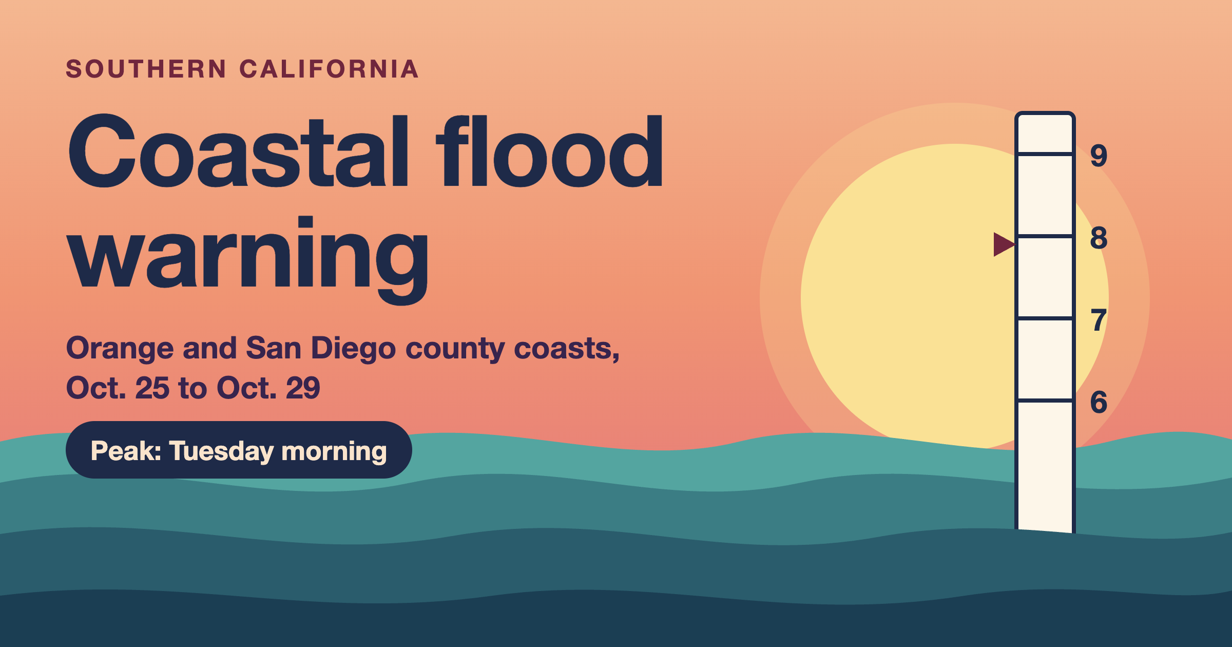
After a wet week, a coastal flood warning now covers the Orange County and San Diego County coasts, and I spent the morning reading what it actually asks people to do. It runs from 5 a.m. Sunday, Oct. 25, to 1 p.m. Thursday, Oct. 29, and the worst water arrives at morning high tide. I read the National Weather Service alert text, the Newport Beach city bulletin, local news reports, Metrolink’s notice and NOAA’s tide predictions, then did some math of my own.
I wrote this on Oct. 24. Also, alerts change fast, so check weather.gov for your own zone before you plan your week.
Coastal flood warning: what the National Weather Service issued
First, the NWS office in San Diego issued the warning for the San Diego County and Orange County coasts. Its text says “significant coastal flooding” is coming, numerous roads may close, and low-lying homes, businesses and some critical infrastructure will take on water. Next, it says tides may run 1 to 1.7 feet above the predicted level, with the high tides in the morning. ABC7 puts the highest tides at Monday through Thursday, with a peak on Tuesday morning.
But not every beach got a warning. The offices to the north put out the lower-level advisory, but they used different wording. Here is the batch side by side:
| Area | Alert | Window | What the alert says |
|---|---|---|---|
| San Diego and Orange County coast | Coastal flood warning | 5 a.m. Sun., Oct. 25 to 1 p.m. Thu., Oct. 29 | Significant flooding; numerous roads may close; homes and businesses inundated |
| Los Angeles County beaches, Malibu, Ventura, Santa Barbara and San Luis Obispo coasts | Coastal flood advisory | 5 a.m. Sun., Oct. 25 to 1 p.m. Thu., Oct. 29 | Minor to moderate flooding over beach parking lots, bike paths and harbor walkways; tides of 7.5 to 8.0 ft |
| San Francisco Bay Area and Monterey Bay | Coastal flood advisory | Oct. 24 or Oct. 26 to 3 p.m. Thu., Oct. 29 | Up to 1.9 ft of water above ground in low-lying areas near the shore |
The Los Angeles and Oxnard office also adds one more line. It sees a small chance of isolated coastal flood warnings on Wednesday and Thursday if larger surf shows up. So the gap between an advisory and a warning is thin this week.
Warning or advisory: what is the difference?
Reading the alerts side by side, the pattern is simple. First, in this batch, an advisory means minor to moderate flooding of parking lots, bike paths and walkways. Second, a warning means significant flooding that closes roads and puts water in buildings. That is my reading of this week’s wording, and each NWS office sets its own thresholds, so I would not treat it as a universal rule.
Why the tides are running so high
NOAA calls “king tide” a popular, non-scientific term for exceptionally high tides. Because of that, they usually show up when a new or full moon lines up with the moon’s closest point to Earth. But the moon alone does not explain this week. NWS meteorologist Dave Munyan told ABC7 that two other things are stacking on top: warmer sea surface temperatures, which expand the water, and Kelvin waves from the ongoing El Niño, which slosh extra water toward the coast.
Next, local officials have put numbers on that extra water. Newport Beach’s Oct. 16 bulletin said ocean levels ran about 15 to 20 inches above predicted tides, and FOX 11 reported 18 to 22 inches four days later. However, the NWS warning says 1 to 1.7 feet. Those ranges overlap, so I would plan around the high end.
The coast has already had a preview. For example, on Oct. 9, swells from Tropical Storm Rachel and a high tide flooded streets on the Balboa Peninsula, and FOX 11 shows cars driving through water halfway up their wheels. So this week is the next test.
How high will the water get this week?
Here is the part I could not find in one place, so I built it myself. NOAA publishes predicted high tides for the Newport Bay Entrance station. Then I added the NWS range of 1 to 1.7 feet on top of each morning high tide:
| Day | NOAA predicted high tide | Time | Plus 1 to 1.7 ft (my math) |
|---|---|---|---|
| Sun., Oct. 25 | 6.2 ft | 8:45 a.m. | 7.2 to 7.9 ft |
| Mon., Oct. 26 | 6.5 ft | 9:15 a.m. | 7.5 to 8.2 ft |
| Tue., Oct. 27 | 6.7 ft | 9:50 a.m. | 7.7 to 8.4 ft |
| Wed., Oct. 28 | 6.6 ft | 10:28 a.m. | 7.6 to 8.3 ft |
| Thu., Oct. 29 | 6.3 ft | 11:14 a.m. | 7.3 to 8.0 ft |
Also, the city’s own line matches. The bulletin says a 6.5-foot forecast could reach 8 feet or more, and ABC7 says Newport Beach expects at least 6 feet from Monday, possibly above 8. Tuesday morning is the highest predicted tide of the week, which fits the Tuesday peak in the news. Still, this is an estimate and not a forecast, since the extra water can change from day to day.
Coastal flood warning checklist: what to do before the morning tide
Overall, this list comes from Newport Beach’s bulletin, FOX 11’s report of the city’s guidance, and the NWS alert text. I only read Newport Beach’s advice, so if you live in another coastal city, look for its own sign-up and sandbag pages.
- Move your car: the city asks people to move vehicles away from flood-prone streets and parking areas. The water peaks in the morning, so I would do it the night before.
- Get sandbags: the city hands out free prefilled bags while supplies last at the Corporation Yard (592 Superior Ave.), Marina Park (1600 W. Balboa Blvd.) and Temporary Fire Station No. 1 (East Ocean Front lot near Balboa Pier). Also, empty bags are at fire stations and Lifeguard Headquarters.
- Check your seawall: look for low sections or openings, because water that tops one seawall can reach the neighbors and the street.
- Clear drains and secure outdoor items: loose furniture floats, and because a blocked drain turns a puddle into a pond.
- Sign up for alerts: Newport Beach texts road closures and evacuation instructions through Newport Notified at nbpd.org.
- Stay off the sand berms: the city asks people to keep a safe distance from heavy machinery and work areas.
However, one rule shows up in every source, and I would follow it above all the others: never drive around a barricade or through water of unknown depth. I wrote more about that in my post on flash flood safety, and it applies to a salt-water street the same way.
Trains and travel during the coastal flood warning
Metrolink will suspend Orange County Line service between Laguna Niguel/Mission Viejo and Oceanside from Monday, Oct. 26, through Friday, Oct. 30. Instead, trains will run only between Los Angeles Union Station and Laguna Niguel/Mission Viejo, and the railroad says it will not provide alternate buses. Likewise, weekend service is not expected to change.
Overall, Metrolink says the move is meant to avoid widespread delays if the coast floods the tracks near San Clemente. However, Amtrak Pacific Surfliner trains will keep running as long as it is safe. In short, check both sites before you leave if your trip crosses that stretch.
Does insurance cover coastal flood damage?
Probably not, at least under a standard homeowners policy. FEMA’s myths and facts sheet answers “not as a rule” and adds that many homeowners learn too late that their policies do not cover flooding. A separate flood policy is the fix, but there is a catch: FEMA says there is typically a 30-day waiting period after you apply and pay before it takes effect.
Now the math. For example, if you bought a policy today and the usual wait applied, coverage would start around Nov. 23. That misses this week, but it would land just before the late-November high tides. FEMA lists exceptions to the wait, including policies a mortgage lender requires, and the same sheet says contents coverage up to $100,000 is also available to renters.
Finally, I should flag that both FEMA pages I read are from 2020, so ask an insurance agent about today’s rules. For people who already have damage, Newport Beach is offering a same-day online express permit for single-family flood repairs from the Rachel storm, with no plans required.
What comes after this coastal flood warning
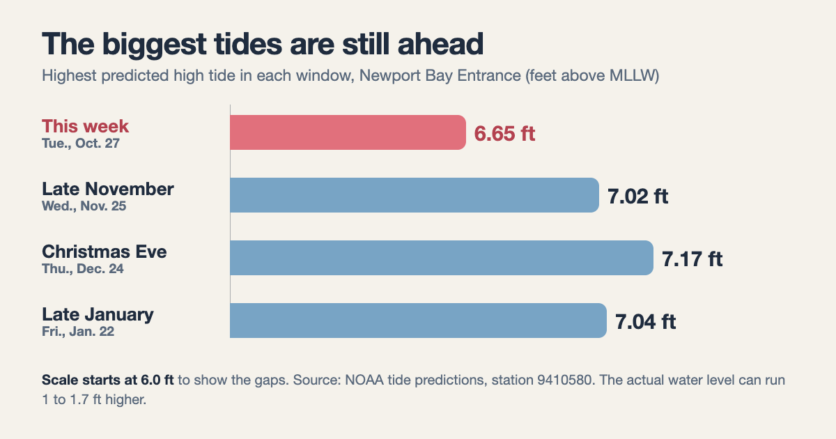
But this week is not the top of the season, and that surprised me. The city’s bulletin says more king tide events are coming in November, December and January, so I checked NOAA’s predictions for the same station in those three windows. In short, the peaks all sit above this week’s 6.7 feet.
Dates to mark on your calendar
| Date | NOAA predicted high tide | Time |
|---|---|---|
| Tue., Oct. 27 | 6.7 ft | 9:50 a.m. |
| Wed., Nov. 25 | 7.0 ft | 8:32 a.m. |
| Thu., Dec. 24 | 7.2 ft | 8:26 a.m. |
| Fri., Jan. 22 | 7.0 ft | 8:23 a.m. |
If the same 1 to 1.7 feet of extra water showed up on Dec. 24, my math puts the water at about 8.2 to 8.9 feet. That is a what-if and not a forecast, because the El Niño boost and ocean temperatures will be different by then. Meanwhile, the City Council approved a project to place about 100,000 cubic yards of sand along the beaches between 36th and 62nd streets, and the Orange County Register reports crews are already moving sand from the Santa Ana River to build up a berm near The Wedge.
My take on the coastal flood warning
Overall, what stands out to me is how much of this is a morning problem. The water peaks between roughly 8:45 and 11:15 a.m., the alerts end at 1 p.m., and the roads that flood are the ones near the bay and the beach. So the best prep is boring: move the car, grab the sandbags, and pick a different route to work.
Still, the unknown is the surf. The Los Angeles office says larger waves could turn some advisories into warnings, so it is worth checking weather.gov again on Tuesday morning.
The short version
A coastal flood warning covers the Orange County and San Diego County coasts from Sunday morning, Oct. 25, to Thursday afternoon, Oct. 29, with the highest morning tide on Tuesday, Oct. 27. Move your car, grab free sandbags, never drive through floodwater, and note that Metrolink cuts service south of Laguna Niguel/Mission Viejo from Oct. 26 to 30.